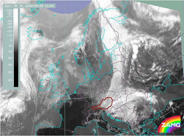
Does this actual case reflect the conceptual model well? Compare the ideal configuration!
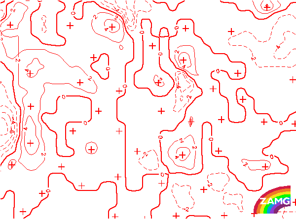
Wind Vectors 1000 hPa:
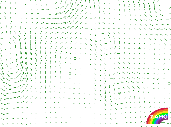
Wind vectors at this low levels clearly show a confluence in the area of the developed Cbs. This is in accordance with the usual configuration in this conceptual model.
Wind vectors at this low levels clearly show a confluence in the area of the developed Cbs. This is in accordance with the usual configuration in this conceptual model.
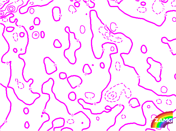
TFP:
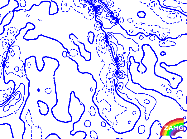
The main TFP is restrichted to the frontal cloud band to the rear of the Convergence Line. It is very well developed. This is as expected in an ideal case. There is a second very short branch of the TFP in the area of the Convergence Line but this is usually not a necessary condition of this conceptual model.
The main TFP is restrichted to the frontal cloud band to the rear of the Convergence Line. It is very well developed. This is as expected in an ideal case. There is a second very short branch of the TFP in the area of the Convergence Line but this is usually not a necessary condition of this conceptual model.
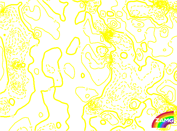
Equivalent Thickness:
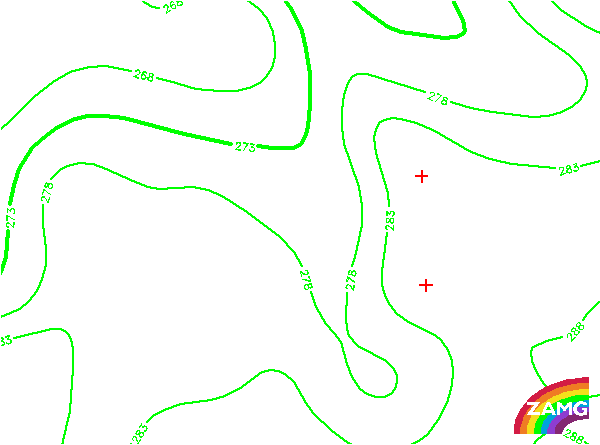
There is a distinct gradient in the thickness within the cloud band of the front. This demonstrates the frontal character very well and is in accordance with the ideal model. The Convergence Line is in the center of the thickness ridge.
There is a distinct gradient in the thickness within the cloud band of the front. This demonstrates the frontal character very well and is in accordance with the ideal model. The Convergence Line is in the center of the thickness ridge.
Temperature Advection 700 hPa:
The zeroline of TA leads through the area of the frontal cloud band. There is a Wave-like structure within the cloud band which is also accompanied by a juxtaposition of a WA and a CA maximum. The Convergence Line is within WA in front of the frontal cloud band. This is a usual configuration.
The zeroline of TA leads through the area of the frontal cloud band. There is a Wave-like structure within the cloud band which is also accompanied by a juxtaposition of a WA and a CA maximum. The Convergence Line is within WA in front of the frontal cloud band. This is a usual configuration.
Divergence:
Although this field is from the global model, the convergence line is clearly recognisable as a bulge in the analysis field. In this case the front at the rear of the convergence line is rather well developed. This deviates from the usual situation as the front band quite often is weak and further weakening.
Although this field is from the global model, the convergence line is clearly recognisable as a bulge in the analysis field. In this case the front at the rear of the convergence line is rather well developed. This deviates from the usual situation as the front band quite often is weak and further weakening.
Vertical Motion (Omega):
As for the field of divergence also in the global analysis of vertical motion the convergence line can be seen in a secondary area of upward motion. And also similar to nearly all other parameters the frontal cloud band is intensive and accompanied by much upward motion which is rather rare in such a situation.
As for the field of divergence also in the global analysis of vertical motion the convergence line can be seen in a secondary area of upward motion. And also similar to nearly all other parameters the frontal cloud band is intensive and accompanied by much upward motion which is rather rare in such a situation.