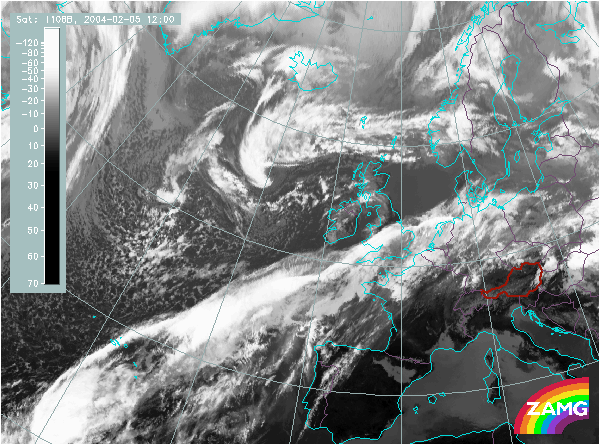
Does this actual case reflect the conceptual model well? Compare the ideal configuration!
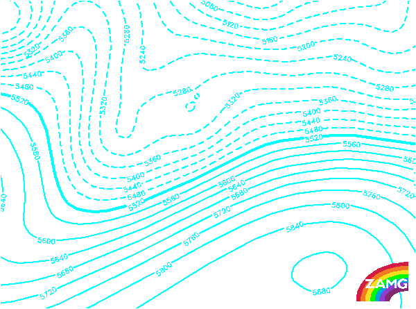

Height Contours 500 hPa:
The EC over the Atlantic is situated exactly in and in front of an intensive upper level trough, which is a very typical situation.
The EC over the Atlantic is situated exactly in and in front of an intensive upper level trough, which is a very typical situation.
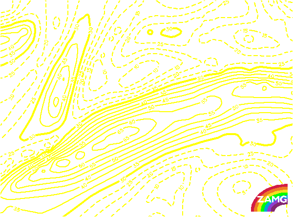
Isotachs 300 hPa:
The jet streak relevant for the development of the EC reaches from the southern tongue of Greenland about twenty degrees southward. The EC is situated on the cyclonic side and in the exit area. This is a quite typical relation.
The jet streak relevant for the development of the EC reaches from the southern tongue of Greenland about twenty degrees southward. The EC is situated on the cyclonic side and in the exit area. This is a quite typical relation.
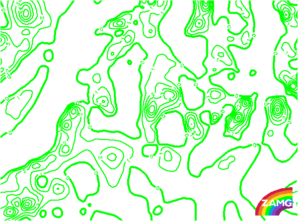
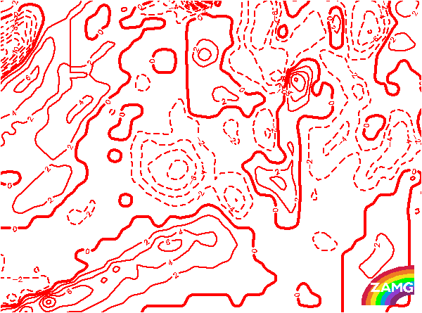
PVA 500 hPa:
The main part of the EC coincides with a maximum of PVA at 500 hPa. Compared to the height contours at 500 hPa, both the PVA maximum and the EC are within and in front of the upper level trough. This corresponds very well to the ideal situation.
The main part of the EC coincides with a maximum of PVA at 500 hPa. Compared to the height contours at 500 hPa, both the PVA maximum and the EC are within and in front of the upper level trough. This corresponds very well to the ideal situation.
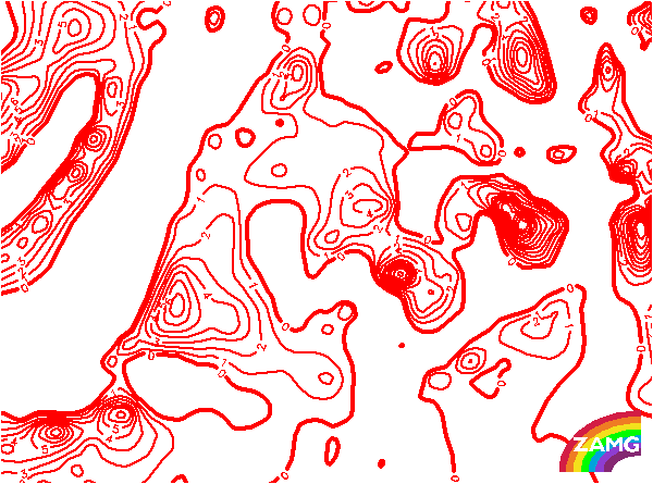
PVA 300 hPa:
At 300 hPa, there is a PVA maximum close to the EC. However, if this is compared to the isotachs at 300 hPa, the PVA maximum is a bit too far away from the left exit region of the north-south oriented jet streak and seems to be related to one of the southwest-northeast oriented jet streaks.
At 300 hPa, there is a PVA maximum close to the EC. However, if this is compared to the isotachs at 300 hPa, the PVA maximum is a bit too far away from the left exit region of the north-south oriented jet streak and seems to be related to one of the southwest-northeast oriented jet streaks.
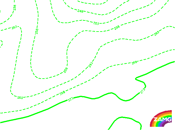
Equivalent Thickness:
As expected in an ideal situation, also in this case the EC is situated in the thickness trough.
As expected in an ideal situation, also in this case the EC is situated in the thickness trough.
Temperature Advection 700 hPa:
The field of temperature advection in this case shows mainly cold advection, but the maxima of cold advection are not coinciding with the EC cloud. There are also some smaller maxima of warm advection. This deviates from the ideal case, but such a deviation happens quite often.
The field of temperature advection in this case shows mainly cold advection, but the maxima of cold advection are not coinciding with the EC cloud. There are also some smaller maxima of warm advection. This deviates from the ideal case, but such a deviation happens quite often.
Showalter index:
The area of the EC is very clearly connected to a Showalter index below three units. This stands for instability, especially in a winter case like this one. Instability fits very well to the ideal situation of an EC.
The area of the EC is very clearly connected to a Showalter index below three units. This stands for instability, especially in a winter case like this one. Instability fits very well to the ideal situation of an EC.