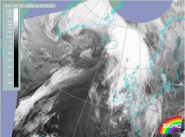
Does this actual case reflect the conceptual model well? Compare the ideal configuration!
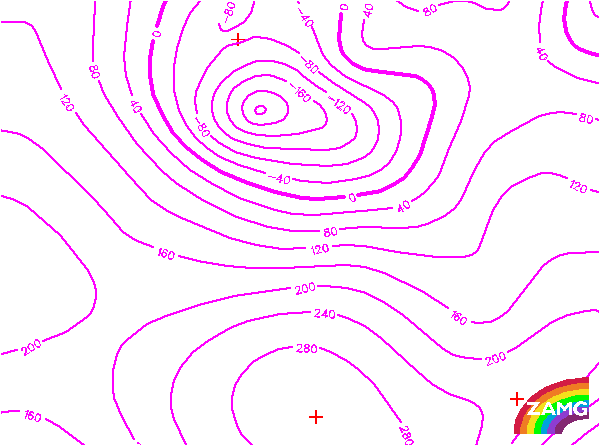
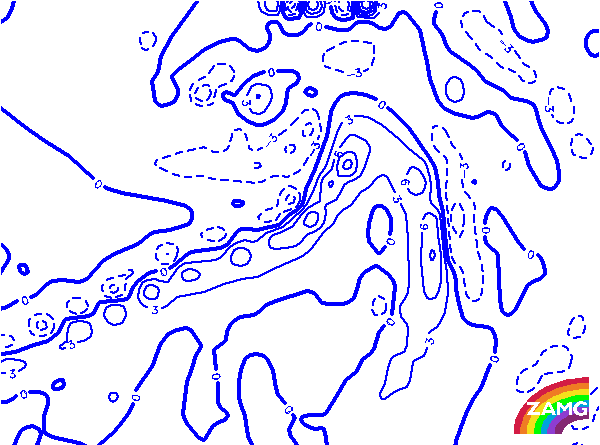
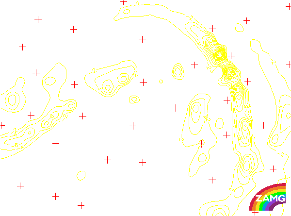
Height Contours 1000 hPa:
At 1000 hPa, there is a distinct surface low in the centre of the cloud spiral leading to a western stream in the area of the Front Decay.
At 1000 hPa, there is a distinct surface low in the centre of the cloud spiral leading to a western stream in the area of the Front Decay.
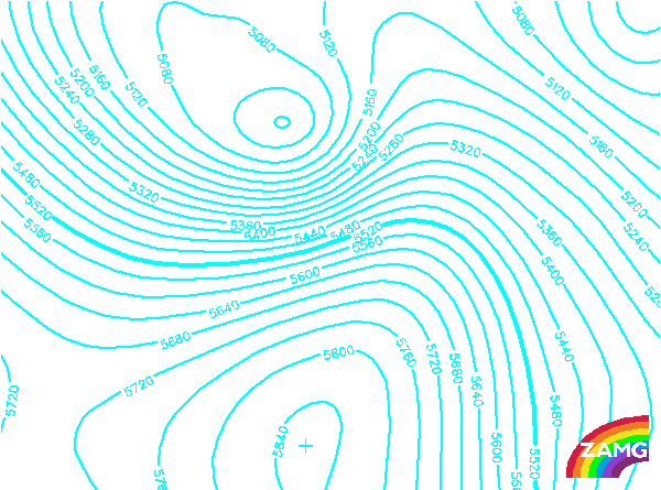
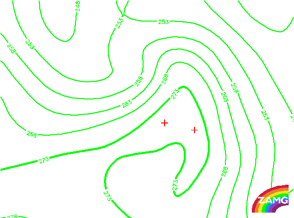
Height contours 500 hPa:
At 500 hPa, there is a distinct low pressure area at the centre of the cloud spiral, and a southwesterly stream in the area of the Front Decay. If height contours at 1000 and 500 hPa are compared, the orientation of the streamlines in the Front Decay area differ, and implies sinking motion.
At 500 hPa, there is a distinct low pressure area at the centre of the cloud spiral, and a southwesterly stream in the area of the Front Decay. If height contours at 1000 and 500 hPa are compared, the orientation of the streamlines in the Front Decay area differ, and implies sinking motion.
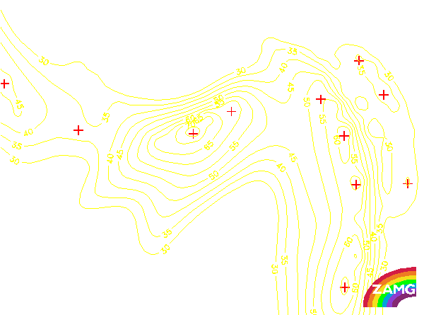
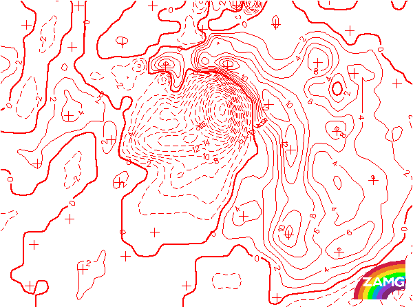
Isotachs 300 hPa:
Isotachs at 300 hPa show a distinct jet streak and the Front Decay area on its anticyclonic side. This is the typical location, but the jet streak in this case is of a smaller scale than usual. Consequently, the Front Decay area cannot only be found in the exit region, which would be the most typical location, but in a much more extended area.
Isotachs at 300 hPa show a distinct jet streak and the Front Decay area on its anticyclonic side. This is the typical location, but the jet streak in this case is of a smaller scale than usual. Consequently, the Front Decay area cannot only be found in the exit region, which would be the most typical location, but in a much more extended area.
TFP:
As usual, the Thermal Front Parameter accompanies the whole frontal cloud band, including the area where the cloud has dissolved.
As usual, the Thermal Front Parameter accompanies the whole frontal cloud band, including the area where the cloud has dissolved.
Equivalent Thickness:
The high thickness gradient, typical for fronts, accompanies the whole frontal cloud band, and also the area of Front Decay. This is the usual situation.
The high thickness gradient, typical for fronts, accompanies the whole frontal cloud band, and also the area of Front Decay. This is the usual situation.
Temperature Advection 700 hPa:
The temperature advection field clearly manifests the most typical configuration for a Front Decay: An extended area of cold advection spreads over the frontal cloud band and reaches also in front of it. This is the main reason for downward motion and cloud dissolution.
The temperature advection field clearly manifests the most typical configuration for a Front Decay: An extended area of cold advection spreads over the frontal cloud band and reaches also in front of it. This is the main reason for downward motion and cloud dissolution.
NVA 500 hPa:
In a typical case, the area of Front Decay is also an area of NVA. This is also the case here, but the NVA area is much smaller in scale.
In a typical case, the area of Front Decay is also an area of NVA. This is also the case here, but the NVA area is much smaller in scale.
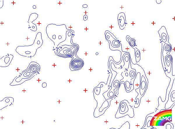
NVA 300 hPa:
Just as for NVA 500 hPa, NVA is also expected at 300 hPa. It should be related to the left exit region of a jet streak. In this case the NVA 300 hPa is rather weak in the area of Front Decay, but extended in the cold air behind. This is a consequence of the form of the jet streak, as can be seen in the isotachs 300 hPa, where the relation of entrance and exit regions and the area of Front Decay is no longer typical.
Just as for NVA 500 hPa, NVA is also expected at 300 hPa. It should be related to the left exit region of a jet streak. In this case the NVA 300 hPa is rather weak in the area of Front Decay, but extended in the cold air behind. This is a consequence of the form of the jet streak, as can be seen in the isotachs 300 hPa, where the relation of entrance and exit regions and the area of Front Decay is no longer typical.