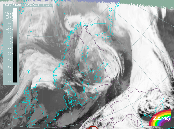

There is a huge jet streak extending from the Norwegian to the Baltic Sea. It shows several typical relations to the cloud configuration:
- the jet axis is exactly where there is a cloud fibre over S-Norway and S-Sweden,
- the crossing of the cloud band over the Baltic States (Lithuania) is well seen in the structure of the image.
It is also interesting to compare the same relation with the two frontal cloud band in the east and in the west of the cloud band under consideration. For both frontal cloud bands the jet streak is nearly parallel to the frontal rear side. Therefore no crossing does happen there and consequently no Front Intensification can take place in the left exit region of the jet streak.
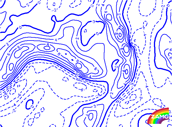
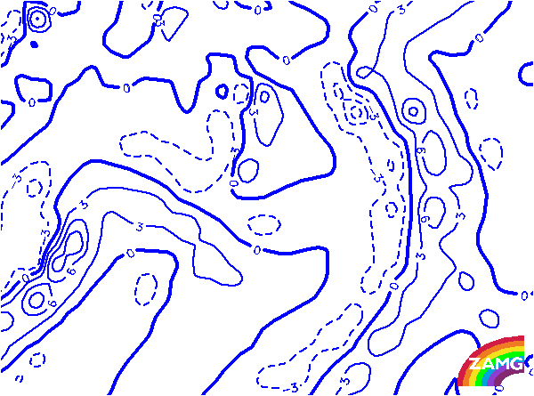
The thick line representing the zeroline of the shear vorticity leads exactly through the jet streak maximum. But even more convincing is the crossing of the frontal cloud band over the Baltic States. This is a very typical relation for such a conceptual model.
The comparison with the two frontal cloud bands to the east and west shows the difference very well: in both cases the zeroline is nearly parallel to the frontal rear side.
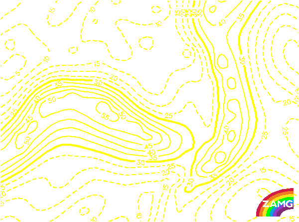
Although the height of 500 hPa is not necessarily the most important height for the identification of the conceptual model of a Front Intensification by Jet Crossing, there is a huge PVA maximum in the area of interest in this case.
There are also huge PVA maxima superimposed on the other frontal cloud bands. They might be produced mainly by upper level troughs
Also at this level which is the most important one, a huge PVA maximum is located over the area of interest. If it is displayed together with the isotachs, the relation of the PVA max in the left exit region of the jets treak is very convincing and is in agreement with the configruation in an ideal case.
There are also huge PVA maxima superimposed on the other frontal cloud bands. They might be produced mainly by upper level troughs.
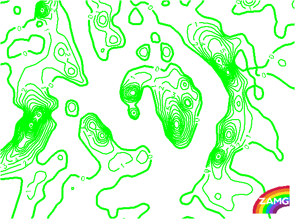
The TFP clearly accompanies the two frontal cloud bands to the east and west of the cloud band under consideration. But for this particular cloud band a deviation from the ideal situation has to be noted. The TFP accompanies only the southern part of the cloudband, the N-S oriented part does not show a distinct TFP. Besides this deficiency, there is no doubt about the conceptual model Front Intensification by Jet Crossing. If the TFP is displayed together with shear vorticity, a distinct crossing point can be recognised over Lithuania.