Relative Humidity:
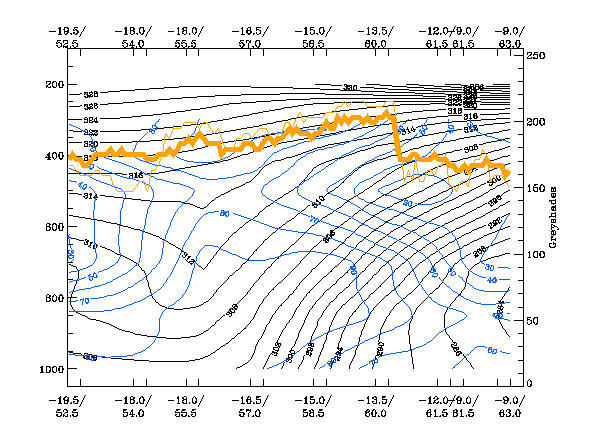
There is a distinct zone of high gradient in the isentropes with the high cloud above of this zone. Cloudiness is accompanied by a distinct maximum of high relative humidity within and above this frontal zone. The distribution is very close to ideal. The zone of dry air in the higher parts of the frontal zone exactly marks the end of the high cloud of the Warm Front Band.
Temperature Advection:
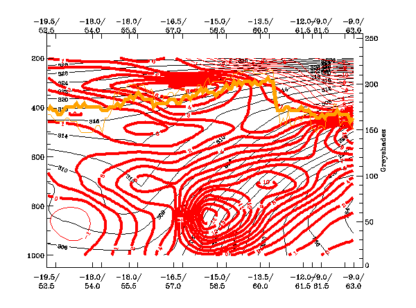
There is an inclined zone of high values of WA within the frontal zone. This is expected in a classical Warm Front Band.
Divergence:
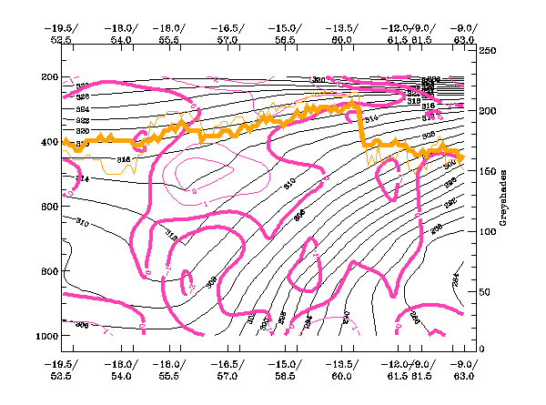
There is an inclined zone of convergence within the frontal zone. This is as expected for this conceptual model. In addition, there is also a maximum of convergence in lower layers, behind the frontal zone. This can be associated with the formation of lower cloud in the warm sector.
Vertical Motion (Omega):
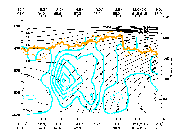
There is lot of upward motion associated with the Warm Front Band and also in the region of the maximum of convergence. Generally, this distribution is in accordance with that expected within a Warm Front Band. However, the enhancement of convegence and upward motion to the rear is a speciality of this case.
Isotachs:
This is a very typical distribution for this Conceptual Model with a strong isotach maximum at a height of around 250
hPa, and along the leading edge of the Warm Front cloud Band.

